2024-11-25
don't find me

2024-11-25
don't find me
2024-11-23
This is still a military technology

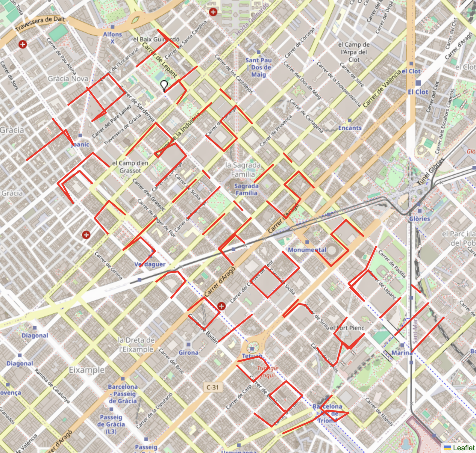
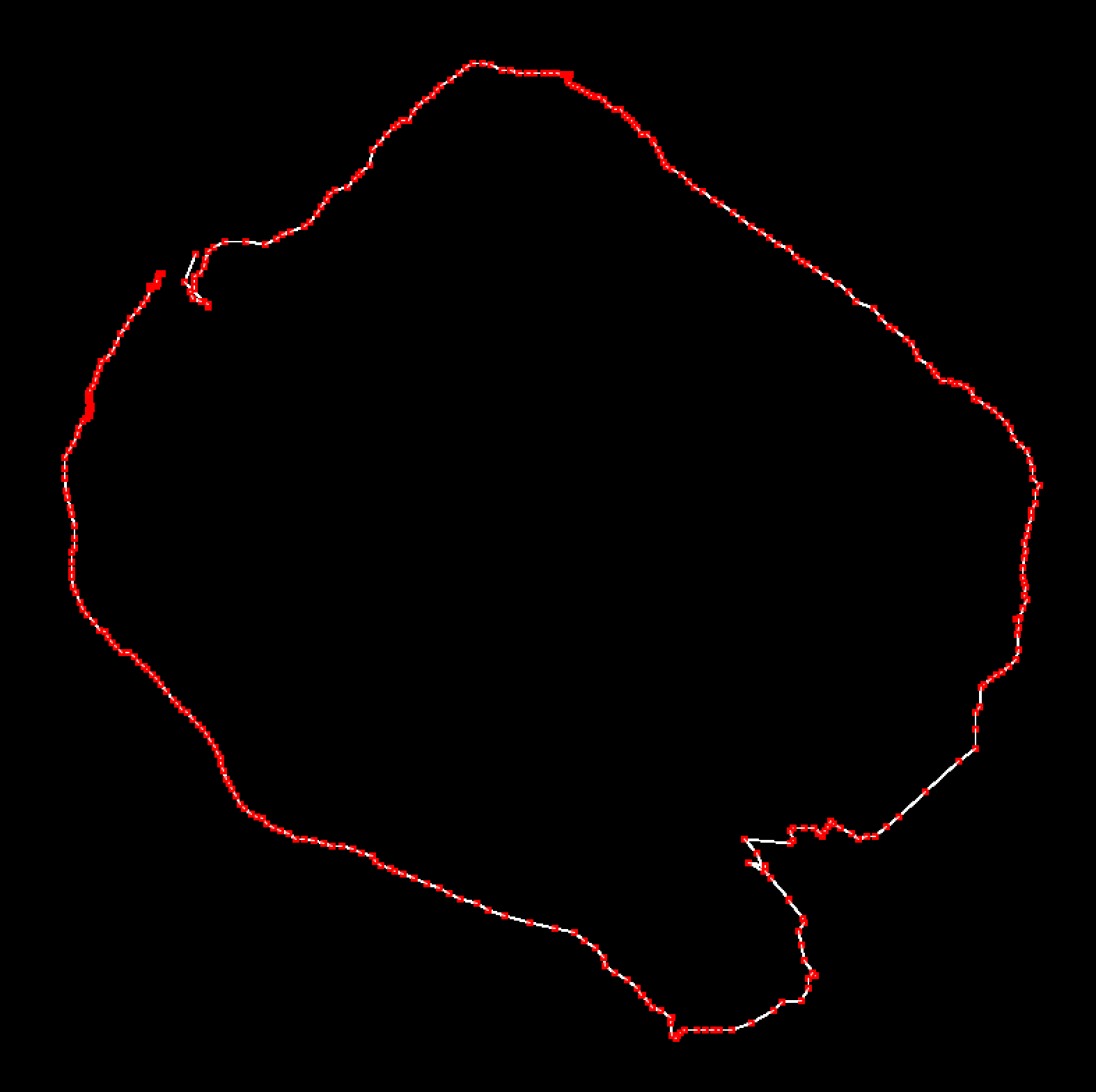
Two days of walking :) I decided to actually walk the phrases, instead of taking a bike. Feels more committed to what I have in mind. GPS/GNSS are somehow semi-civilized technologies. Or seem like this. And I think and feel like this might be, because of how convenient they make our everyday lifes. So maybe doing my drawing in a bit inconvenient way is a good approach to reflect on that...
Anyway, I'm happy how it turned out. And it's a bit funny how the ending point (the top right point of the *y*) happend to be directly in front of the arc de triomf.
2024-11-22
This is still a military technology
this is probably going to take three days.... or maybe i can take a bike!
2024-11-21
Grounding Political Subjectivity

I had to adjust the sizing a bit so it becomes walkable. The visible traces are around 15km and I split it up over two days. The total walking was around 25-30km.
It made me think a lot about - if I'm drawing/writing by walking, what would be the rhetorics of walking? Or here some notes:
what does it mean to walk a poem? (given foot refers to the meter of a poem) what rhymes with corners, crossings, trees by the road, construction sites? what are the rhetorics of walking?
language finds its way
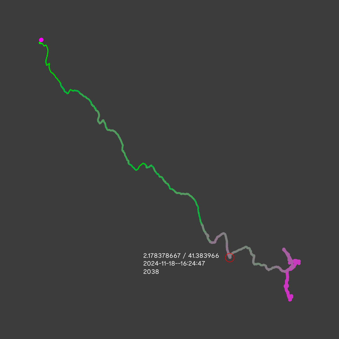
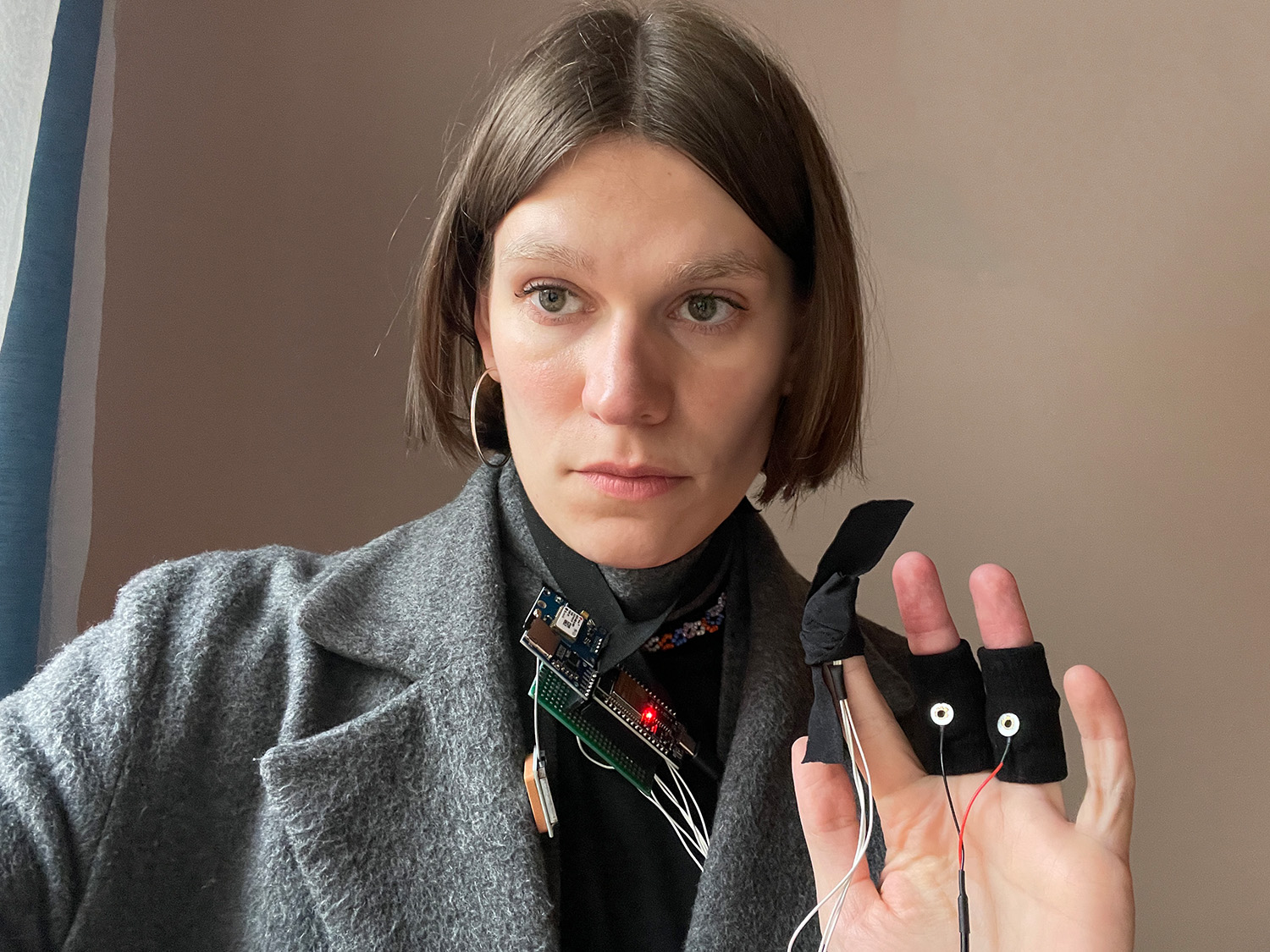
2024-11-18
Walking a straight line
wearing the prototype:
2024-11-16
rethinking GPS abbrevations:
initializing local positioning system
...
2024-11-14
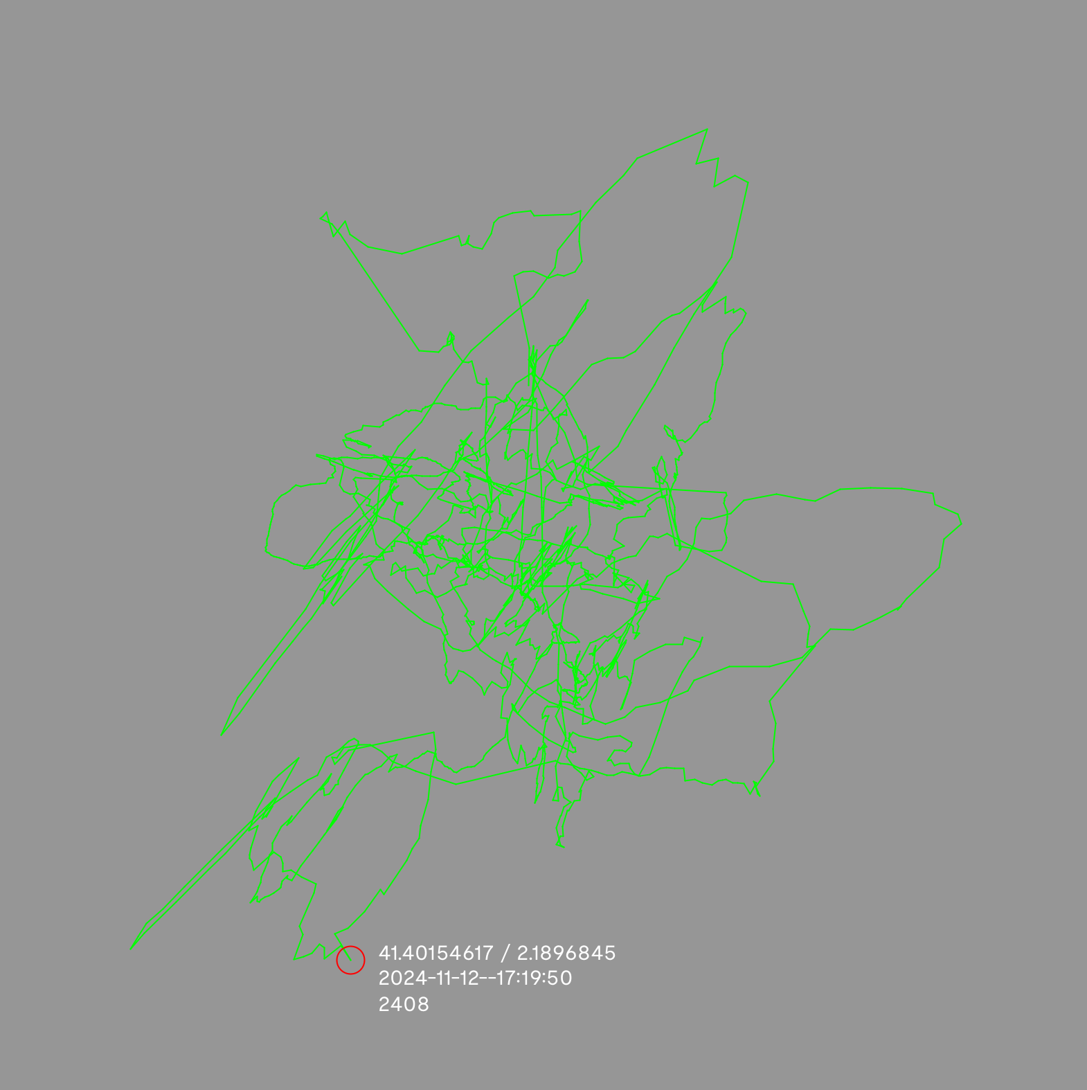
Standing still
2024-11-09
Making some first footage
2024-11-09
"Grounding Political Subjectivity"
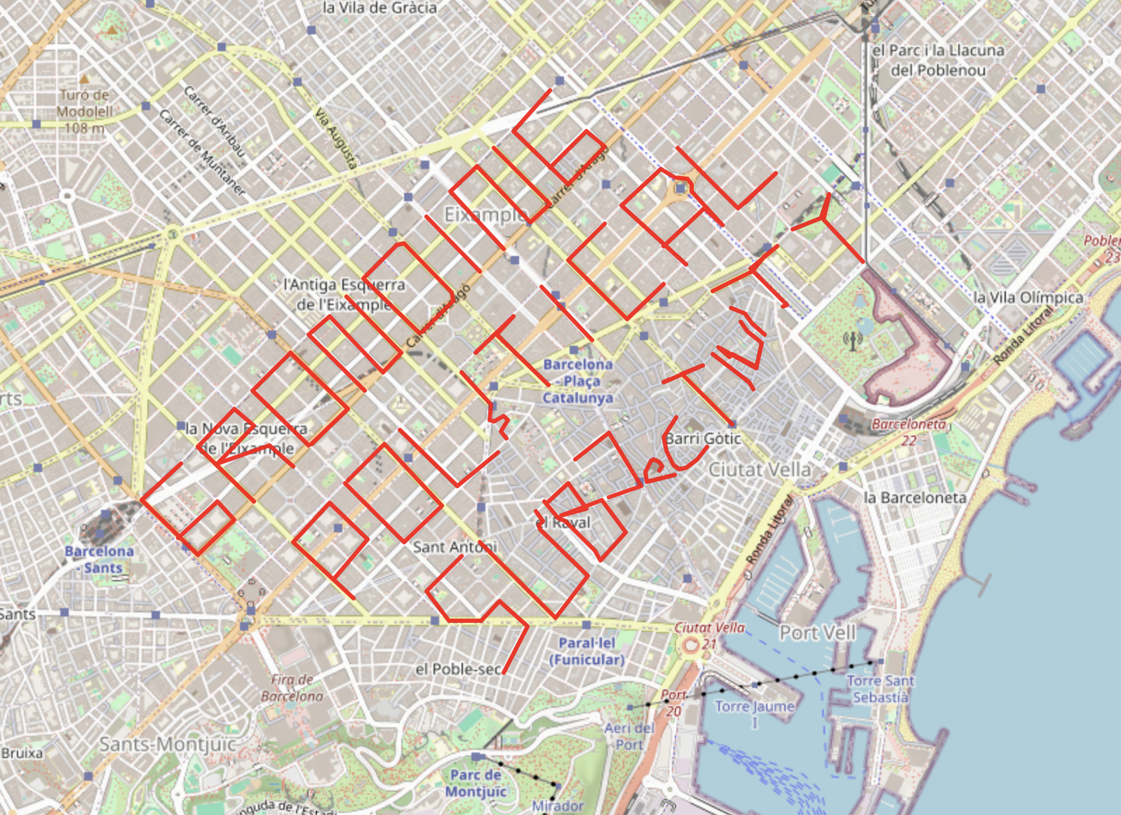
Made with this tool: https://www.gpsvisualizer.com/draw/
The full quote:
Another crucial element of my cartographic approach is the feminist politics of locations (Rich, 1987), also known as situated knowledges (Harding, 1986, 1991; Haraway, 1988), which I take as the original manifestation of embodied and embedded carnal empiricism. This method accounts for one’s locations in terms both of space (geo-political or ecological dimension) and time (historical memory or genealogical dimension), thereby grounding political subjectivity. The emphasis on immanence marks the rejection of transcendental universalism and mind-body dualism. All matter or substance being one and immanent to itself, it is intelligent and self-organizing in both human and non-human organisms (Lloyd, 1994, 1996; Protevi, 2013). Vital matter is driven by the ontological desire for the expression of its innermost freedom (conatus). This understanding of matter animates the composition of posthuman subjects of knowledge – embedded, embodied and yet flowing in a web of relations with human and non-human others. Vital neo-materialism will also provide the ontological grounding for the critical posthumanities as a transversal field of knowledge. More on this later.
from: Rosi Braidotti: A Theoretical Framework for the Critical Posthumanities (2018)
https://journals.sagepub.com/doi/10.1177/0263276418771486
2024-11-07
Some more resources
https://natronics.github.io/blag/2014/gps-prn/
https://blank005.tripod.com/gps/psedo_random.html
https://www.youtube.com/watch?v=yK1Q6fN6Q7g
2024-11-06
A test with mapping a galvanic skin response (GSR) sensor with GPS:
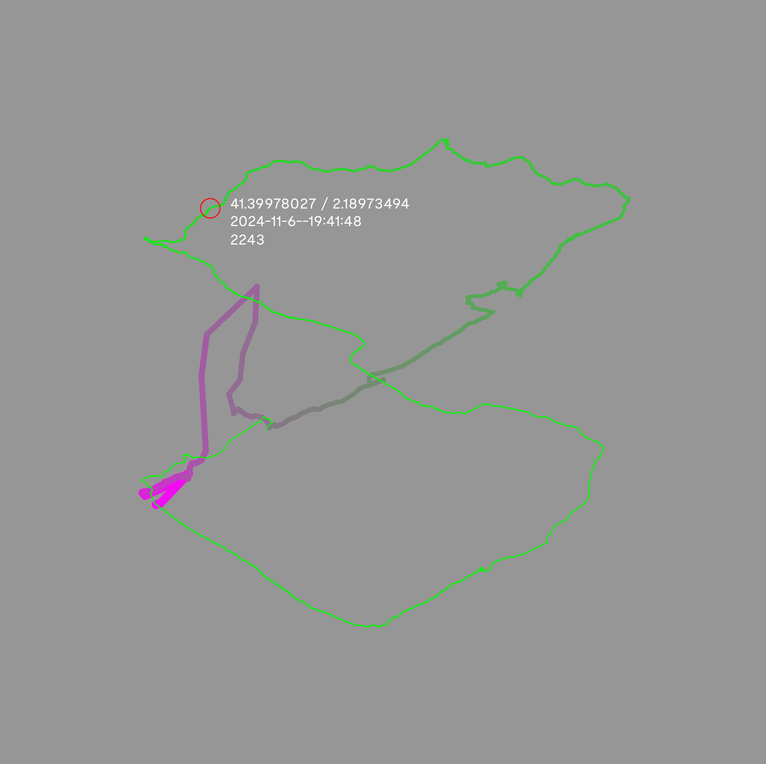
It's a bit cold outside. So you can see how in the beginning my GSR values are relatively high at 1923 (which means I'm more sweaty -> my skin is less resistive), and then as I walk around the block for 15min I get colder over time and my skin gets less sweaty/conductive.
2024-11-05
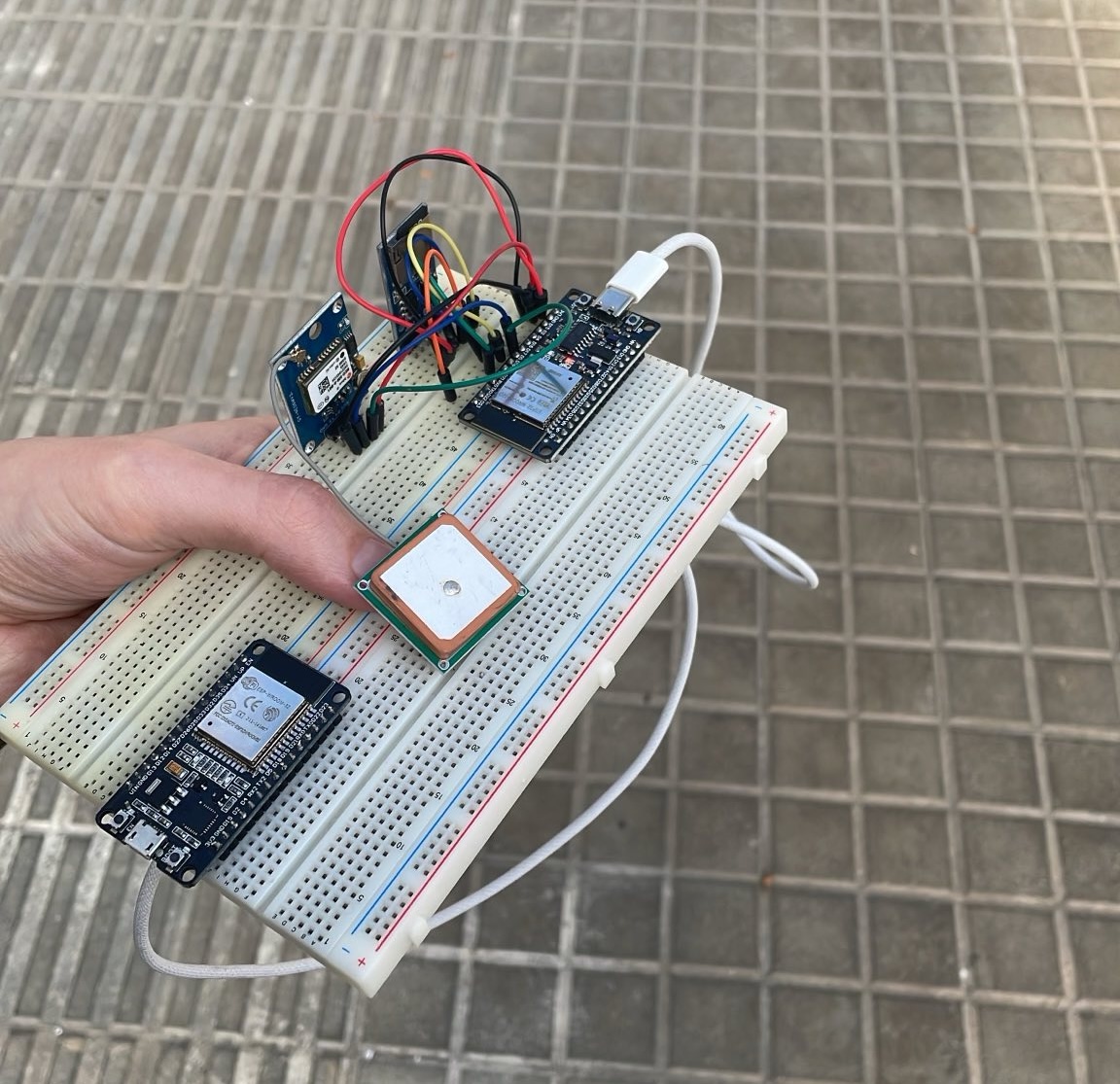
¡Hola GPS!
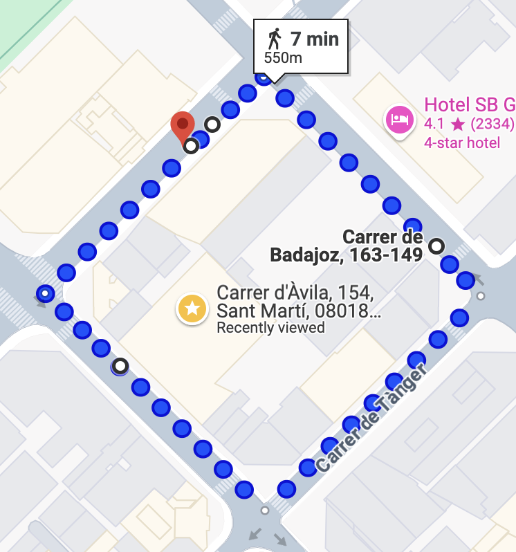
Hmmmmmmmm. Today I set up a small breadboard circuit that connects the ESP32 to a micro sd card module and the NEO-6M GPS module ... and the readings are quite bad! hihi
I was taking a walk around the block, which should have looked like this:
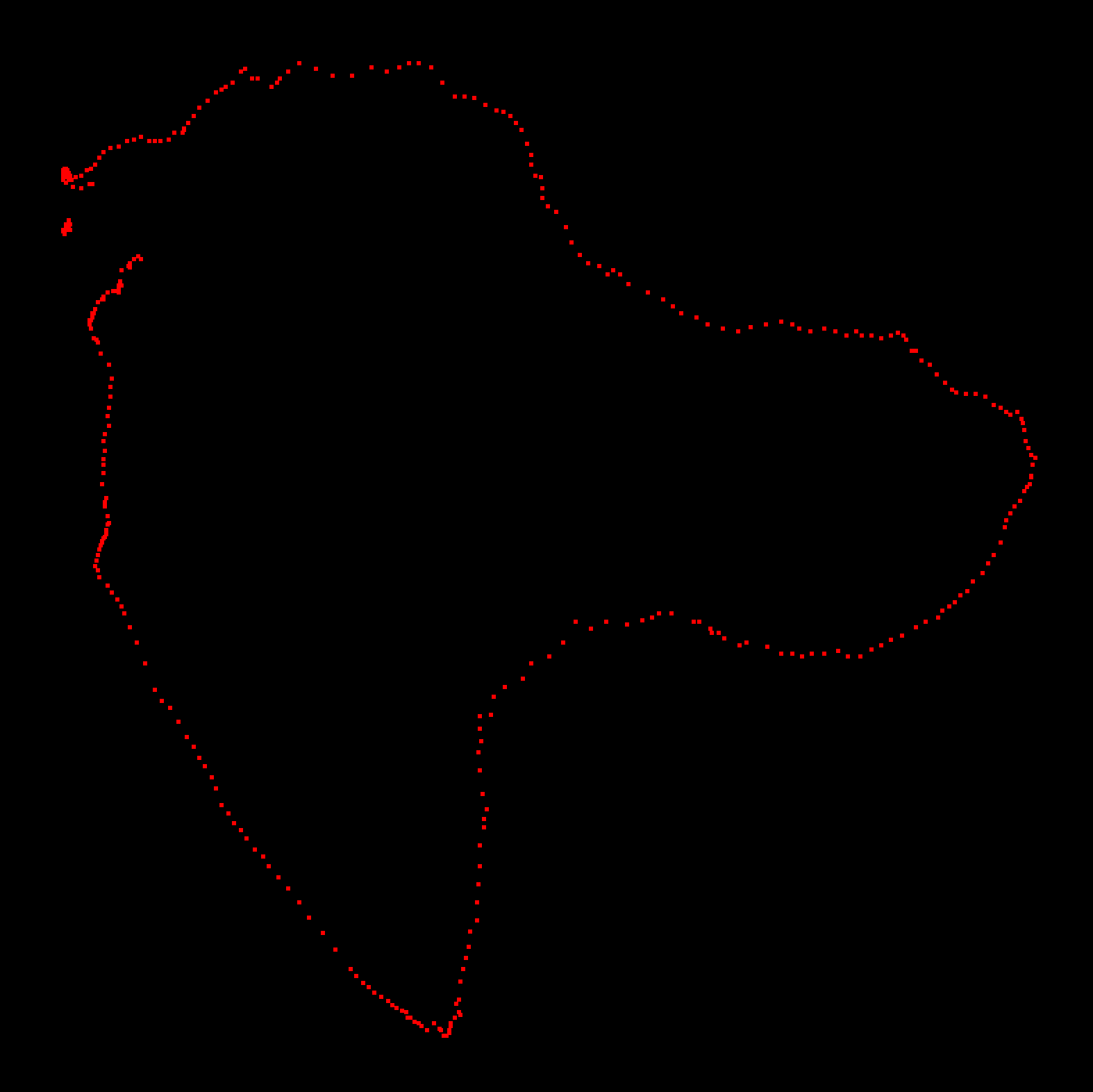
But looks like this:
I wonder if this is caused by the other GPS antenna that I attached to the module. It was promised to be better than the original ceramic GPS antenna. I will go take one more round with the other antenna and see how it turns out.
...
The original "worse" antenna works much better. Still wiggly, but at least a somewhat recognizable square.
My setup:
Here it is how it looks with a bit better visualization:

For now I am working with this Arduino/ESP32 code + this Processing sketch (to visualize the data). The format for each data entry is at the moment a custom format I decided on:
<2024-11-5--15:35:44;41.40121841/2.18974471>
<YYYY-MM-DD--HH:mm:SS;LAT/LNG>
ISO 8601 😎
2024-11-05
Research questions in progress
2024-11-04
Anecdotes / References
GPS proves Einstein's special and general relativity true, because the satellites travel at around 14 000 km/h and we're rotating slower on Earth's surface. So according to the special relativity theorem the atomic clock of the satellites will experience time slower (around 7µs per day). And since the satellites are around 20 000 km far away from Earth's surface, gravity affects the satellites less than it affects us (and our computing devices) on the surface. This difference in time dilation (wtf so crazy this needs to be considered) is 45µs per day. So combined 38µs per day, which would shift GPS to lose 10km of accuracy each per day (source)
It's so interesting how the methods (and their implied politics) of location / locating / navigation are so tightly tied to temporality: The GPS / GNSS updates our phones times, so that they can more accurately calculate their position. Or in other words: In order for this space conception to work, where everything knows where it is (in the sense of this spatial framework), every device needs to be synchronized first. A universal global politics of location relies on one universal time.
“Contemporary neuroscience suggests the existence of fundamental algorithms by which all sensory transduction is translated into the intrinsic, brain-specific code. Direct stimulation of these codes within the human temporal or limbic cortices by applied electromagnetic patterns may require energy levels which are within the range of both geomagnetic activity and contemporary communication networks.”
[On the Possibility of Directly Accessing Every Human Brain by Electromagnetic Induction of Fundamental Algorithms. Michael A. Persinger. 1995]
GPS has initially been a military technology. And I was approaching this residency kind of assuming that it has become a "civil" technology now... But actually it is still used for military purposes: missile target locating or as a intentional GPS jamming so the enemy can't navigate themself. It just has been commercialized for consumer market. But as a military technology it is now extended through AI analysis tools:
https://www.theguardian.com/world/2024/apr/03/israel-gaza-ai-database-hamas-airstrikes
https://www.theguardian.com/world/2023/dec/01/the-gospel-how-israel-uses-ai-to-select-bombing-targets
Some more references:
https://medium.com/@penrosewang/introduction-to-gnss-ii-gps-signal-processing-dd9eae0bdade
Hiawatha Bray: You Are Here - From the Compass to GPS, the History and Future of How We Find Ourselves (2014)
Martin Howse / V2: Becoming Geological (2023)
Martin Howse: Psychogeophysics Walker ()
2024-11-03
Ongoing list of quotes, as basis for GPS drawings
2024-10-15
Preparations
Global navigation satellite system (GNSS) is a general term describing any satellite constellation that provides positioning, navigation, and timing (PNT) services on a global or regional basis - (GNSS also synchronizes our clocks)
https://randomnerdtutorials.com/esp32-how-to-log-data/
https://randomnerdtutorials.com/esp32-data-logging-temperature-to-microsd-card/
https://randomnerdtutorials.com/esp32-neo-6m-gps-module-arduino/
The *Local Positioning System* (LPS) explores GPS, in particular the efforts of demilitarization around it, and their implications for human connection to the land. In general, it involves collecting quotes/anecdotes on local embedding. The quotes draw together strands of research on the history of GPS, psychogeophysics (Howse), eco/techno feminist thought (Haraway, Braidotti) and Indigenous knowledge ("place-thought" Watts).
Coupled with the poetic engineering of a DIY GPS tracker and a sensing module to capture embodied data, e.g. heartbeat rate, EEG, myography, a camera facing the ground, skin resistance. Using the custom electronics, I will then draw-walk them onto maps. Conceptually, this attempts to generate an immersive experience into the local eco/geo/techno/bio/psycho/medial networks.
The results could then be etched/milled/laser-engraved live, while reading out the quotes or A/V-performing the embodied qualitative data.
schedule:
SAT 2024-11-02 -- MON 2024-11-04
arrival, setting up, initialize brain for residency mode :)
MON 2024-11-04 -- FRI 2024-11-08
custom electronics for GPS drawings
+ collecting embodied data
start programming rendering tools for the embodied data
reading texts for more quotes
FRI 2024-11-08 -- FRI 2024-11-22
generating (up to 8?) GPS drawings + collection of embodied data
> THU 2024-11-28 -- SAT 2024-11-30
final presentations
equipment:
installation materials:
Installation sketch:
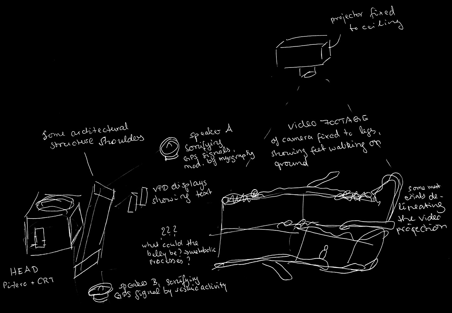
A field/body that embeds/embodies multiple media + data recordings
Head
can be a CRT-TV driven by ESP32 that visualizes ? -> maybe multiple heads?
Eyes
Ears
Loudspeakers?
Earlobes
place for the heart-beat sensor
Shoulders
Architectural structure; If my body was a semiconductor device / IC, my shoulders would largely be made from plastics
Heart
Maybe a display that shows theoretical reflections of what's "going on" hihi
Stomach
What kind of metabolic process comes with a body taking a walk on itself?
Maybe material samples? => every 10min a material sample from the ground?
Legs
a gyroscope/myography sensor that records data while walking, maybe can be sonified?
Feet
The "foot" might be video recordings of my feet while walking, a camera strapped to my legs; projected onto the floor in the shape of feet